Source
from IPython.display import IFrame
import pandas as pd
import sage_data_client
import holoviews as hv
import hvplot.pandas
from metpy.units import units
import metpy.calc as mpcalc
from bokeh.models import DatetimeTickFormatter
import sage_data_client

hv.extension("bokeh")

def apply_formatter(plot, element):
    plot.handles['xaxis'].formatter = DatetimeTickFormatter(hours='%m/%d/%Y \n %l:%M %p',
                                                            minutes='%m/%d/%Y \n %l:%M %p',
                                                            hourmin='%m/%d/%Y \n %l:%M %p',
                                                            days='%m/%d/%Y \n %l:%M %p',
                                                            months='%m/%d/%Y \n %l:%M %p')

def add_local_time(df):
    df["Local_Time"] = pd.to_datetime(df.index,unit='s', utc=True)\
                          .map(lambda x: x.tz_convert('America/Chicago'))
    return df
import warnings
warnings.filterwarnings('ignore')
Loading...
Temperature and Dewpoint
Source
wxt_df = sage_data_client.query(
    start="-12h",
    filter={
        "vsn": "W0A4",
        "name": "wxt.env.temp|wxt.env.humidity"
    }
).set_index("timestamp")

temp_df = wxt_df.loc[wxt_df.name == "wxt.env.temp"]
hum_df = wxt_df.loc[wxt_df.name == "wxt.env.humidity"]

min_df = temp_df[["value"]].resample("1min").mean()
min_df["rh"] = hum_df[["value"]].resample("1min").mean()

min_df["tmpf"] = (min_df.value.values * units.degC).to("degF").m
min_df["dwpf"] = mpcalc.dewpoint_from_relative_humidity(min_df.tmpf.values * units.degF,
                                       min_df.rh.values * units.percent).to("degF").m

min_df = add_local_time(min_df)

temp_plot = min_df.hvplot(x='Local_Time',
                          y='tmpf',
                          color = "r",
                          label="Temperature [degF]"
                         )
dewp_plot = min_df.hvplot(x='Local_Time',
                          y='dwpf',
                          color="g",
                          title="Current Weather at Argonne National Laboratory (ATMOS)",
                          label="Dewpoint [degF]",
                          ylabel="Temperature | Dewpoint \n [degF]",
                          xlabel="Local Time (Central/US)")

(temp_plot * dewp_plot).opts(hooks=[apply_formatter], legend_position='right')
Loading...
Air Quality
Source
df = sage_data_client.query(
    start="-12h",
    filter={
        "vsn": "W0A4",
        "name": "aqt.particle.pm2.5"
    }
).set_index("timestamp")

df = add_local_time(df)[["value", "Local_Time"]].resample("5min").mean()

df.hvplot(label='PM 2.5 Values at Argonne National Laboratory (ATMOS)',
          x='Local_Time',
          y='value',
          ylabel='PM 2.5 \n [microgram per cubic meter]',
          xlabel="Local Time (Central/US)").opts(hooks=[apply_formatter])
Loading...
Cloud Base Height and Vertical Profile
Measurements from a ceilometer which shows the cloud base height and vertical profile above the site.
Source
import os
import requests
from IPython.display import Image
import sage_data_client

def readtofile(uurl, fname, input_args):
    """
    Given a URL, read data to local files

    Parameters
    ----------
    uurl : str
        HTML consisting of file to download from Beehive
    fname : str
        Path for local location to store data into
    input_args : dictionary
        Input Argument dictionary
    """
    r = requests.get(uurl,
                     auth=(input_args["user"], input_args["password"]),
                     timeout=25)
    if r.status_code == 200:
        with open(fname, 'wb') as out:
            for bits in r.iter_content():
                out.write(bits)
    elif r.status_code == 404:
        print("404 Error: File Not Found")
    else:
        print("HTML Request Status - ", r.status_code)
    return Image(f"$GITHUB_WORKSPACE/content/site-level-weather/current-atmos-cl61.png", width=600)


df = sage_data_client.query(
    start="-12h",
    filter={
        "plugin": "registry.sagecontinuum.org/bhupendraraut/cl61-plot:0.25.*",
        "vsn": "W09A"
    }
)


# Grab the most recent image
uurl = df.value.values[-1]
input_args = {
    "user": os.getenv("WAGGLE_USERNAME"),
    "password": os.getenv("WAGGLE_PASSWORD")
}
outpath = os.getcwd() + "/current-atmos-cl61.png"
readtofile(uurl, outpath, input_args)
HTML Request Status - 401
---------------------------------------------------------------------------
TypeError                                 Traceback (most recent call last)
File ~/micromamba/envs/geospatial-analysis-dev/lib/python3.12/site-packages/IPython/core/display.py:1100, in Image._data_and_metadata(self, always_both)
   1099 try:
-> 1100     b64_data = b2a_base64(self.data, newline=False).decode("ascii")
   1101 except TypeError as e:

TypeError: a bytes-like object is required, not 'str'

The above exception was the direct cause of the following exception:

FileNotFoundError                         Traceback (most recent call last)
File ~/micromamba/envs/geospatial-analysis-dev/lib/python3.12/site-packages/IPython/core/formatters.py:1036, in MimeBundleFormatter.__call__(self, obj, include, exclude)
   1033     method = get_real_method(obj, self.print_method)
   1035     if method is not None:
-> 1036         return method(include=include, exclude=exclude)
   1037     return None
   1038 else:

File ~/micromamba/envs/geospatial-analysis-dev/lib/python3.12/site-packages/IPython/core/display.py:1090, in Image._repr_mimebundle_(self, include, exclude)
   1088 if self.embed:
   1089     mimetype = self._mimetype
-> 1090     data, metadata = self._data_and_metadata(always_both=True)
   1091     if metadata:
   1092         metadata = {mimetype: metadata}

File ~/micromamba/envs/geospatial-analysis-dev/lib/python3.12/site-packages/IPython/core/display.py:1102, in Image._data_and_metadata(self, always_both)
   1100     b64_data = b2a_base64(self.data, newline=False).decode("ascii")
   1101 except TypeError as e:
-> 1102     raise FileNotFoundError(
   1103         "No such file or directory: '%s'" % (self.data)) from e
   1104 md = {}
   1105 if self.metadata:

FileNotFoundError: No such file or directory: '$GITHUB_WORKSPACE/content/site-level-weather/current-atmos-cl61.png'
---------------------------------------------------------------------------
TypeError Traceback (most recent call last)
File ~/micromamba/envs/geospatial-analysis-dev/lib/python3.12/site-packages/IPython/core/display.py:1100, in Image._data_and_metadata(self, always_both)
1099 try:
-> 1100 b64_data = b2a_base64(self.data, newline=False).decode("ascii")
1101 except TypeError as e:
TypeError: a bytes-like object is required, not 'str'
The above exception was the direct cause of the following exception:
FileNotFoundError Traceback (most recent call last)
File ~/micromamba/envs/geospatial-analysis-dev/lib/python3.12/site-packages/IPython/core/formatters.py:406, in BaseFormatter.__call__(self, obj)
404 method = get_real_method(obj, self.print_method)
405 if method is not None:
--> 406 return method()
407 return None
408 else:
File ~/micromamba/envs/geospatial-analysis-dev/lib/python3.12/site-packages/IPython/core/display.py:1122, in Image._repr_png_(self)
1120 def _repr_png_(self):
1121 if self.embed and self.format == self._FMT_PNG:
-> 1122 return self._data_and_metadata()
File ~/micromamba/envs/geospatial-analysis-dev/lib/python3.12/site-packages/IPython/core/display.py:1102, in Image._data_and_metadata(self, always_both)
1100 b64_data = b2a_base64(self.data, newline=False).decode("ascii")
1101 except TypeError as e:
-> 1102 raise FileNotFoundError(
1103 "No such file or directory: '%s'" % (self.data)) from e
1104 md = {}
1105 if self.metadata:
FileNotFoundError: No such file or directory: '$GITHUB_WORKSPACE/content/site-level-weather/current-atmos-cl61.png'<IPython.core.display.Image object>Location
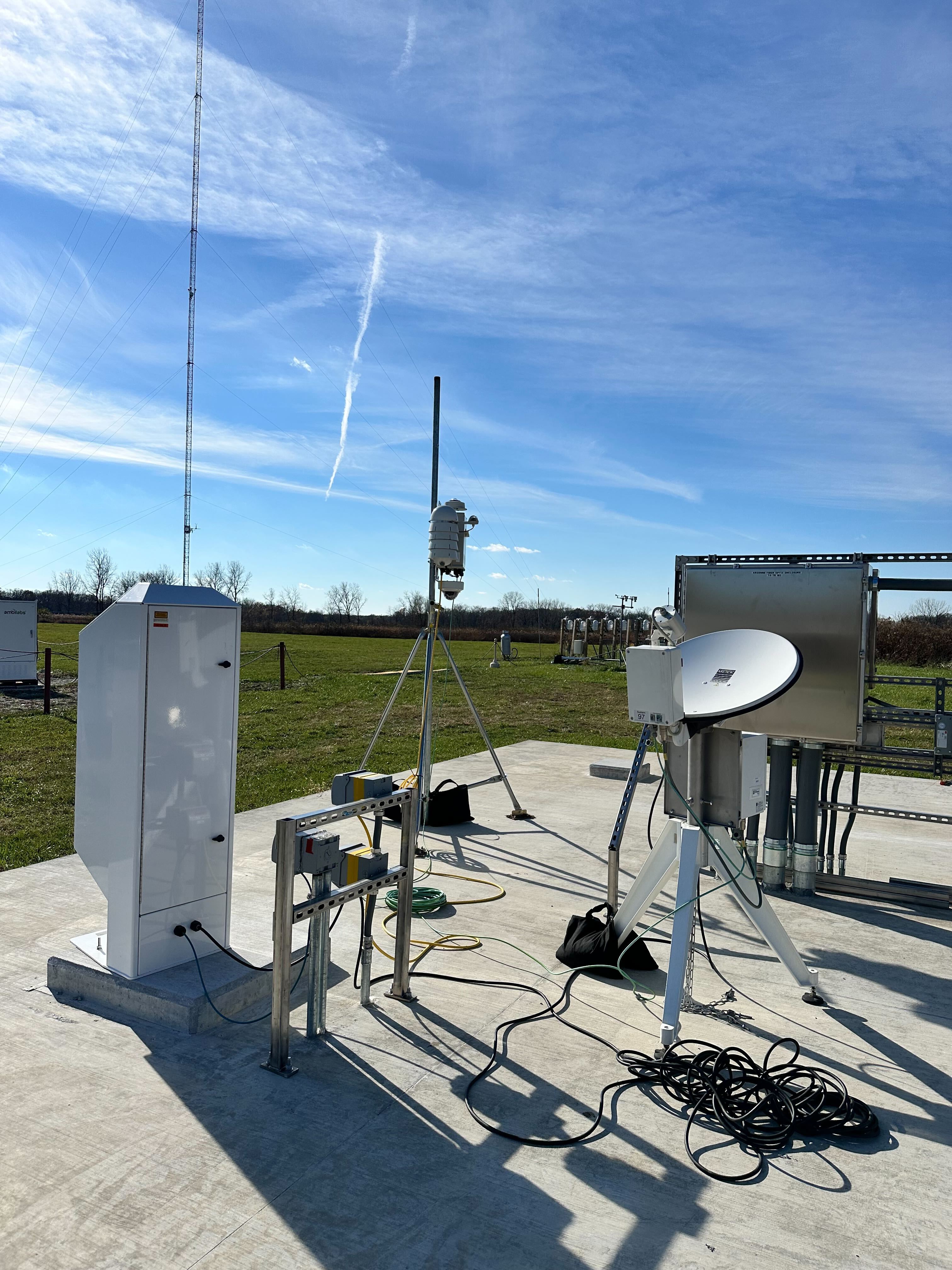
Observations from the Argonne National Laboratory, at the Argonne Testbed for Multiscale Observational Science (ATMOS).
Source
IFrame("https://www.google.com/maps/embed?pb=!1m17!1m12!1m3!1d1127.9916583864983!2d-87.99606298327078!3d41.70155707281444!2m3!1f0!2f0!3f0!3m2!1i1024!2i768!4f13.1!3m2!1m1!2zNDHCsDQyJzA1LjciTiA4N8KwNTknNDIuNSJX!5e1!3m2!1sen!2sus!4v1745338004627!5m2!1sen!2sus", width=700, height=350)Loading...